One of the things that amazes me about the topography of Northern Vancouver Island is how the mountains come to an abrupt end between Port McNeill and Port Hardy.
This is most obvious when you’re coming south on the Island Highway.
A few kilometres before you get to the port Alice turn-off you are face to face with a fairly large mountain that seems to lay just the other side of the Seven Hills Golf Course.
The mountain you are looking at is the end of the range that runs down the middle of Vancouver Island.
Everything from here to Cape Scott is small in comparison.
This is the first of the ranges that meet your eye as you travel down island.
As you go by Nimpkish Lake the Karmutzen Range makes up the other shore and is gorgeous when the winter snows powder its slopes; but one of the most outstanding as well as the most visible from the highway is Pinder Peak.
It is part of a small range that is accessible by and near to the Zeballos road.
As I travel beside Nimpkish Lake I have to be careful to keep my eyes on the road because I never cease to marvel at its imposing hooked shape.
In the winter it gathers a lot of snow to create a fascinating display.
To really appreciate this mountain, however, you have to spend some time on one of the many lakes that mirror its image.
Nimpkish Lake is, of course, the easiest place to view it, starting at its north end, close to where the Nimpkish River leaves the lake.
From the beach there, a wonderful view presents itself , as you look up the lake at the Pinder Range in the distance.
This is about as far as one can be from the peak and still get a clear view.
The Island Highway certainly has many views as you travel along beside the lake but perhaps the best one of all is from the windsurfer’s campsite at the top end of this large body of water.
From here on, in order to have a good look at Pinder from one of the delightful lakes I’ve been raving about, you need to travel down the Zeballos road.
These lakes, in order of accessibility are: Tsiko Lake (locally known as Loon Lake), Anutz Lake, Hustan Lake, DianeLake and Atluk Lake.
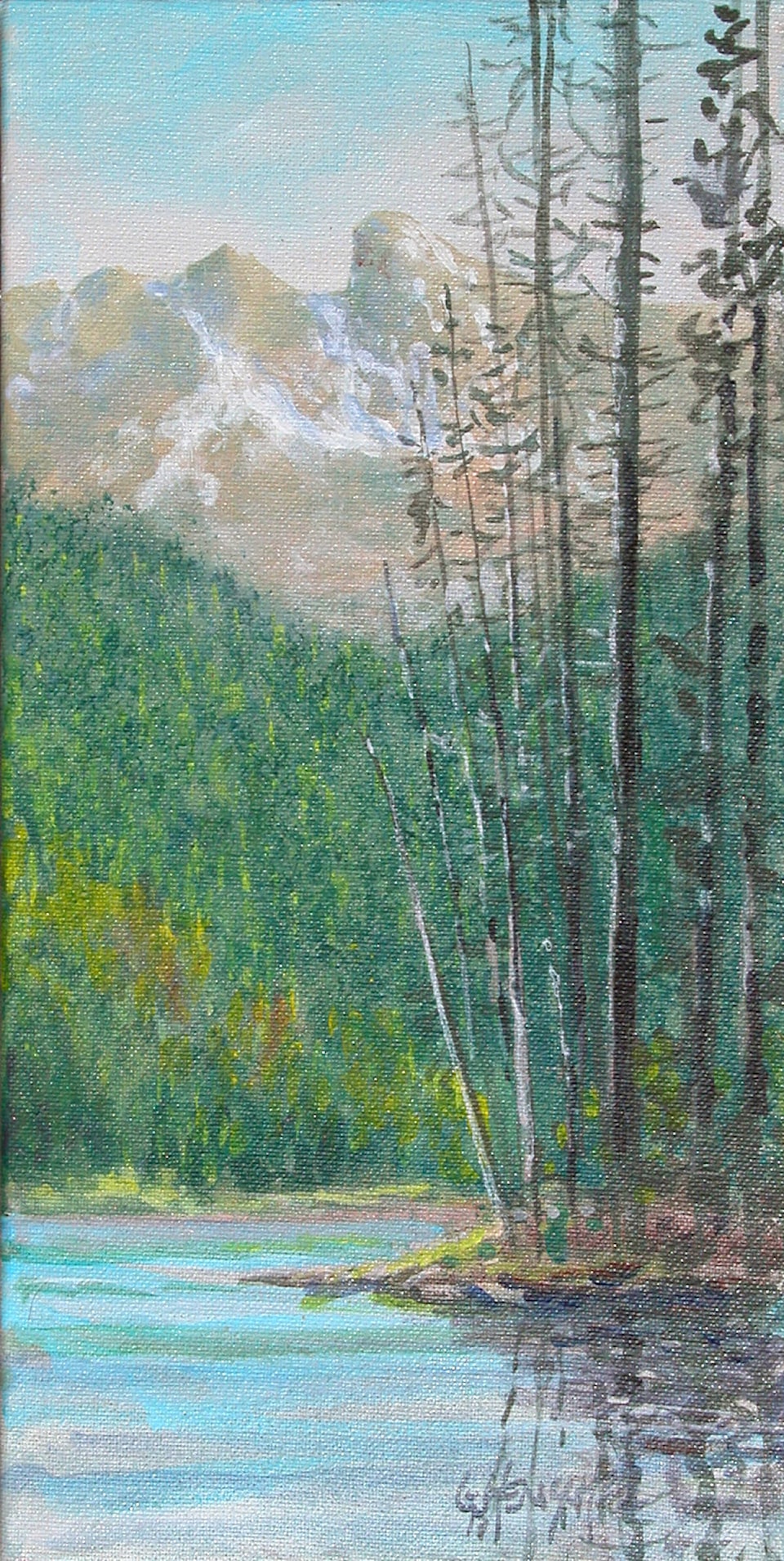
I have painted on all of them with Diane, the one pictured here, being the latest.
I very nearly missed Diane while I was looking for Hustan Lake. The easiest way to get there is from the Anutz Lake road.
Go by Anutz Lake itself, continue on by the Hustan Cave turnoff and then watch carefully for the Diane Lake sign.
It appears rather quickly on this road that meanders along high above Hustan Lake, eventually connecting with the Atluk Main.
Once you make the turn into the Diane Lake road, you are almost there, but you will be frustrated because there is literally no view of the lake except for the odd glimpse through the trees.
You really need a canoe or kayak to see to see this little gem but it is well worth the trouble.
There is only one, easy to miss, small place for launching so you have to watch closely for the opening in the trees between the road and the lake.
One of the picturesque little islands that lie on the far end of the lake provided a picnic site. Spending a few hours there in full view of the mighty Pinder Range was not a difficult task. Painting, fishing and solitude is about as good as it gets!
Comments? email: gordon@cablerocket.com.
Website: www.henschel.ca