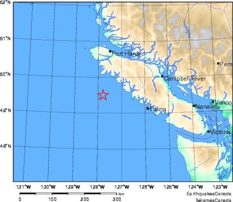
A magnitude 6.3 earthquake struck Wednesday evening approximately 137 kilometres (85 miles) southwest of Port Alice, but no damage was reported and no tsunami warning was issued in the wake of the temblor, the West Coast and Alaska Tsunami Centre reported.
Natural Resources Canada said no reports of damage would be expected from the quake, which struck at 6:01 p.m. Nov. 7. The U.S. National Ocean and Atmospheric Administration indicated it was a deep quake, occurring at a depth of approximately 43 kilometres.
The quake occurred just less than 12 hours after a magnitude 4.0 aftershock hit in the Haida Gwaii region, the most recent notable aftershock since a major 7.7-magnitude quake struck the area the evening of Oct. 27. That quake resulted in a tsunami warning that encompassed North Vancouver Island and led to evacuations of low-lying areas in and around Port Hardy and Port McNeill.
The Haida Gwaii quake did not produce a major tsunami or cause damage, though aftershocks rated at magnitudes of 4.0 and higher continue to shake the region more than a week after the initial earthquake struck.