While heavy rain will come to much of B.C., the central coast will bear the brunt of this next storm, said an Environment Canada emergency preparedness meteorologist.
Speaking on Monday (Nov. 29), Armel Castellan said that the Bella Coola valley could expect up to 200 millimetres of rain when the third in a series of atmospheric rivers hits the province on Tuesday.
“The central coast will be the peak for this event,” Castellan said during the province’s flood update. The central coast and the west side of Vancouver Island north of Tofino will be the worst hit until the weather begins to clear Wednesday evening, giving the province a two-day break before rain is expected again on Saturday.
The River Forecast Centre has issued a flood watch for the central coast and northern Vancouver Island.
Public Safety Minister Mike Farnworth said that officials are working with the Bella Coola region to determine their needs.
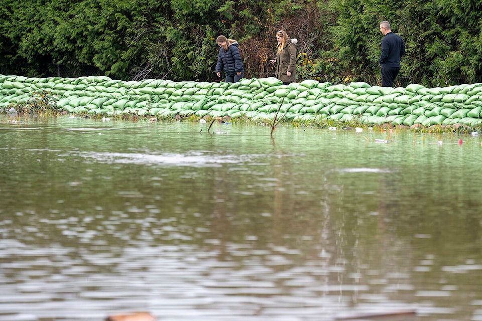
“A hydrologist is on their way up to that region to assist in in planning,” Farnworth said. “There have been assets deployed – sandbags, for example – to assist in strengthening areas that may require it.”
The Canadian Armed Forces, who have already been helping in flood-ravaged communities including Princeton and Abbotsford, will also be deployed.
“It will deliver a relatively strong punch, similar to what we saw this weekend,” Castellan said. The storm will bring 50 to 100 millimetres to the south coast. Regions near the border will get closer to 50 millimetres, while areas like Hope could see 60-90 millimetres. Abbotsford, also already dealing with flooding, is expected to get 40 to 70 millimetres.
Castellan said that there will be a “fair amount” of rain that will fall in the upper elevations near the Coquihalla highway and that the storm will raise the freezing levels to 2,500 metres, which he said would push it above the mountain tops.
“It’s not just a rain event, it’s not just a snow-melting event, it’s also a successive storm event,” he said. “So even if the storm event is not as bad as it could have been… it will be problematic because they are coming so close back to back with the runoff and the saturated ground.”
Castellan said that the north coast is expected to see up to 40 centimetres of snow, followed by rain, including some frozen rain. Areas like Blue River, Golden and the Shuswap will see a change from lower freezing levels to high ones and a “good amount” of rain.
“The whole province is bracing for this kind of weather.”
READ MORE: B.C. extends gas rationing, state of emergency until Dec. 14 as storms continue