A new minerals research project that is expected to bring new mineral exploration interest to northern Vancouver Island officially commenced on July 29.
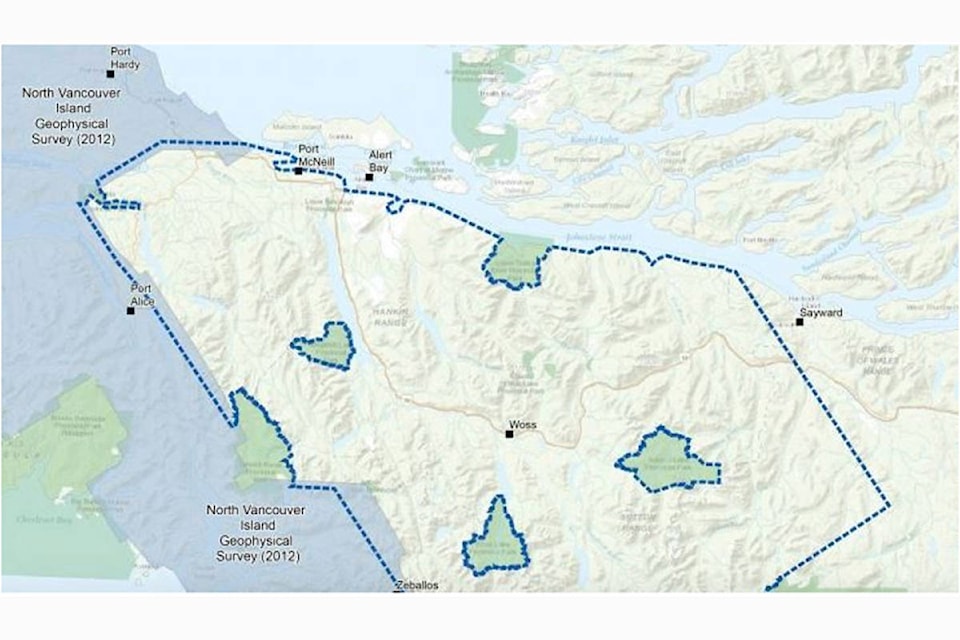
Geoscience BC’s Vancouver Island North project is a survey using a helicopter to identify areas with potential for mineral deposits, and follows on from research conducted by Geoscience BC in 2012.
Langley-based company Precision GeoSurveys was selected to collect new, high resolution data in a 6,127 square kilometre area stretching from Port McNeill in the north to Tahsis in the south.
The helicopter is based at Port McNeill and Woss and will fly a total of almost 27,000 kilometres along lines 250 metres apart.
It will fly at a constant height of 80 metres, but will rise to 300 metres over larger communities.
It will not fly over Woss Lake, Nimpkish Lake or Schoen Lake Provincial Parks.
The helicopter can be easily identified by three ‘booms’ – one on each side and one at the front. Its registration is ‘C-GSVY’.
Weather permitting, the survey is expected to be complete by September 30.
Commenting on the news, Geoscience BC Vice President, Minerals Christa Pellett said: “New large datasets are a powerful tool in identifying new natural resource opportunities, and are essential to informed decisions relating to the development of BC’s mineral resources.”
Once the survey is complete, magnetic and radiometric data will be processed and then published at Vancouver’s AME Roundup conference in January 2020.
As with all projects funded by Geoscience BC, the data from the project will be available publicly.
Since announcing the project in March, Geoscience BC has shared project plans with industry, community and Indigenous leaders.
Feedback was included before issuing a Request for Proposals from potential contractors in June.
Anyone who may have questions about this helicopter survey project can contact Richard Truman at Geoscience BC – truman@geosciencebc.com or call 604-662-4147.
- Submitted article courtesy of Geoscience BC